Clan Stuart Wreck
Clan Stuart Wreck
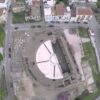
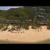
Clan Stuart Wreck, Dive Site, Cape Town, An Aerial View Mackerel Bay, Main rd, 7975, South Africa Please embed this or any of our videos on your website! If you don't know how, contact us.The Clan Stuart was built in 1900; this triple expansion steam engine ship, weighing 3,594 tons, dimension of 35 x 4 x 2,5m, was built by W. Doxford and Son, Sunderland, England. The ship was not designed to withstand weather even though it was freight-only ship; instead the ship was designed to overcome the restrictions of the Suez Canal since ships were charged tax fees depending on the breadth of the beam.There are three different versions of how the Clan Stuart arrived in South African waters; the first version says she arrived at Simon’s Town from St. Helena to deliver her consignment of coal to Wales, while the second version says she arrived after providing coal to the Astraea. The later version states that she was on a naval requisition order after a coal delivery to St. Helena. These three versions have only one common fact and that is the Clan Stuart arrived in Simon’s Bay because of a coal delivery.On her arrival she was “near-light” hence almost empty. The Clan Stuart was anchored in the Bay. At 2am on 21 November 1914 a south-Easter gale force wind caught her off guard resulting in her been dragged and eventually she ran hard aground, dragging her anchor as she was pulled on the rocks near Glencairn beach. Her cargo was saved and the crew were rescued by lifeline.The tug, Ludwig Wiener pulled her off the rocks and towed her back to Simon’s Town dry docks for repairs. However she was refused permission to enter until further repairs because of danger of her foundering in the approach-channel. Therefore she was run ashore on Mackerel Beach just 100 meters from the sandy beach, and she was linked to the beach via a cable. Two anchors were used to keep her steady and prevent her from sinking.Captain Burns of Glasgow Salvage Company sent divers in to inspect the Clan Stuart and reported that she was salvable, however repairs would be costly .The repair work was given the go ahead but all efforts were futile. As a last resort, a wooden coffer dam was built around the damaged plates. However, this collapsed when the ship was refloated and the engine room was flooded.This is an easily accessible shore dive, with adequate parking and well protected from south westerly swell. It is suitable for training and night dives, and has quite a diverse population of reef animals and some interesting wreckage.Visibility is not usually particularly good, as the site is close inshore and the surge can be strong, but it is not usually too bad either, and can be judged moderately accurately from the shore.The wreck lies in fairly shallow water (about 8m) The area is mostly fine sand with occasional low sandstone outcrops. The iron structure of the wreck has become very broken up over the years. A section of the triple expansion steam engine framework structure extends above water, with the low pressure cylinder mountings to the south west. The crankshaft, connecting rods and propeller shaft with large cast iron propeller are still in place. There appear to be the remains of a condenser on the port side of the engine. Just forward of the engine are the remains of the two coal-fired scotch boilers. Both have been dislodged from their mountings, and are lying on their sides with the cylindrical furnaces lying one above the other. The walls have rusted through in places and the tie-rods are clearly visible The wreck lies at about 45° to the shoreline. The bow at the north east end is about 30m from the engine block and is the deepest part at about 9m. The plating has largely rusted away, but a fair amount of framing is still recognisable. The stern at the south west end is about 15m from the engine block and is both the shallowest part and closest to the beach. Most of the wreckage is very low, but there are a few places where it is possible to get into covered areas. A long angled section of plating on the port side forms a small low tunnel many metres long, probably too small to get through in places, but you can see light from one end to other, and both ends are open.Geology: Sand bottom with occasional outcrops of sandstone reef, probably of the Ordovician Peninsula formation, but possibly of the underlying Graafwater formation. Strike is close to east-west. and dip about 10° to the south.


